¶ TerraScan
| Company | Terrasolid |
| Country | Finland |
| Website | https://terrasolid.com/products/terrascan/ |
| Category | Planning & Inventory › Remote sensing & mapping |
managing and processing all types of point clouds
¶ Overview
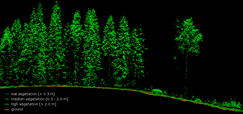
TerraScan is a professional LiDAR point cloud processing software developed by Terrasolid, a Finnish company specialising in airborne and mobile laser scanning solutions. The software operates as a plug-in within Bentley MicroStation and as a standalone application, enabling users to process, classify, and analyse massive point cloud datasets acquired from airborne, mobile, and terrestrial LiDAR sensors. TerraScan uses sophisticated algorithms to automatically classify raw point cloud data into distinct categories such as ground, vegetation, buildings, power lines, and other terrain features, dramatically reducing the manual effort required for large-scale surveys. In the forestry context, TerraScan plays a central role in forest inventory and structure analysis. By processing dense airborne LiDAR datasets, it enables the extraction of key forest metrics including canopy height models, digital terrain models, individual tree detection, crown delineation, and stem density estimates. These outputs feed into forest management planning, timber volume estimation, and habitat assessment workflows. In Australia, TerraScan is used by government agencies, research institutions, and commercial forestry operators to analyse plantation and native forest assets across vast, often difficult-to-access terrain. It supports compliance with environmental reporting requirements and informs sustainable harvesting decisions by providing accurate, spatially continuous data about forest structure. The software also integrates with Terrasolid's companion products — TerraStereo for stereo image processing and TerraPhoto for aerial imagery — forming a complete suite for geospatial data production. Recent developments have focused on improving automation in classification routines, handling the ever-increasing point densities produced by modern multi-return sensors, and enhancing compatibility with drone-based LiDAR systems, which are becoming increasingly common in operational forestry and ecological monitoring in Australia and globally.
¶ Assessment
A strong option for accurate forest inventory and planning, with clear risk-reduction benefits via improved hazard detection and mapping precision.
¶ Details
| Field | Value |
|---|---|
| Company | Terrasolid |
| Country | Finland |
| Type | Company |
| FWPA RD&E | 7.3 |