¶ Satellite Hyperspectral imaging
| Company | Pixxel |
| Website | [Pixxel |
| Category | Planning & Inventory › Remote sensing & mapping |
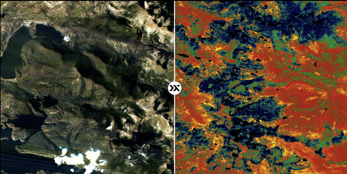
5m Hyperspectral for monitoring soil, vegetation health etc..
¶ Overview
Satellite hyperspectral imaging is a form of remote sensing in which spaceborne sensors capture reflected electromagnetic radiation across hundreds of contiguous, narrow spectral bands — typically spanning the visible, near-infrared, and shortwave-infrared portions of the spectrum — rather than the handful of broad bands recorded by conventional multispectral satellites. This fine spectral resolution allows each pixel to be characterised by a near-continuous spectral signature, enabling the identification of specific chemical and structural properties of vegetation that are invisible to multispectral sensors. For forestry, the most significant applications include tree species mapping at the stand and individual-crown level, detection of nutrient deficiencies and foliar chemistry (nitrogen, chlorophyll, water content, lignin), early identification of pest and disease stress before visible symptoms appear, assessment of fire fuel moisture content, and discrimination of invasive plant species from native understorey. Satellites such as the Italian PRISMA, the German EnMAP (launched 2022), and NASA's planned SBG (Surface Biology and Geology) mission represent a new generation of civilian hyperspectral platforms offering global, repeated coverage at spatial resolutions of 20–30 metres. In Australia, which hosts some of the world's most biodiverse and commercially important forest systems, hyperspectral satellite data is being integrated into forest health monitoring programs and carbon accounting workflows. The Terrestrial Ecosystem Research Network (TERN) and CSIRO have actively developed algorithms calibrated to Australian eucalypt forests, where subtle canopy biochemical signals can indicate drought stress, myrtle rust incursion, or Phytophthora cinnamomi (dieback) infection well before mortality occurs. As satellite revisit frequencies improve and analysis-ready data products become accessible through cloud platforms, hyperspectral imaging is transitioning from a specialist research tool to an operational component of plantation and native forest management.
¶ Assessment
A strong monitoring tool that supports yield protection through early detection of pest, disease, and stress indicators.
¶ Details
| Field | Value |
|---|---|
| Company | Pixxel |
| Type | Company |
| FWPA RD&E | 7.4 |