¶ Productivity tracking of forest machinery
| Authors | Mologni et al. |
| Country | University of British Columbia, Canada |
| Paper (PDF) | View paper |
| Category | Harvesting & Extraction › Remote sensing & mapping |
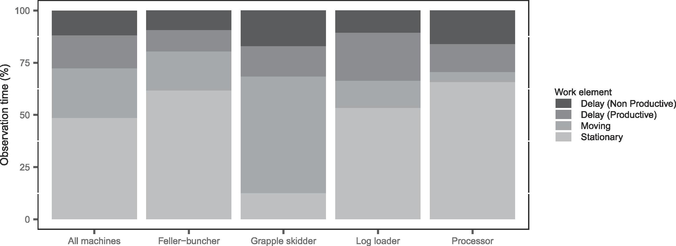
productivity rates and accuracy of those
0
¶ Overview
Productivity tracking of forest machinery refers to the systematic collection, analysis, and reporting of operational performance data from harvesting and forwarding machines to optimise efficiency, reduce costs, and support planning decisions in forest operations. Modern cut-to-length harvesters and forwarders are equipped with onboard computers — such as the Ponsse OPTI system, Komatsu Forestry's MaxiFleet, or John Deere's JD Link — that continuously log data on machine working time, idle time, delays, fuel consumption, stem volumes processed, log assortments produced, and operator activities. This data is typically transmitted via cellular or satellite telematics networks to cloud-based management platforms where it can be visualised in dashboards, used to generate productivity reports, and benchmarked against targets or historical performance. Productivity metrics such as productive machine hours (PMH), scheduled machine hours (SMH), machine utilisation, and volume per productive hour (m3/PMH) are standard indicators used by forest managers and contractors to assess operational efficiency. In Australian forestry, productivity tracking is increasingly important given the high capital cost of modern forest machines — which can exceed AUD $1 million — and the need to maximise return on investment in competitive contract environments. Data from productivity tracking systems also supports maintenance scheduling through condition monitoring, reducing unplanned downtime. Research organisations including the University of Tasmania's Forest Practices Unit and CSIRO have investigated productivity tracking data to understand the factors influencing machine performance across different stand types, terrain conditions, and harvesting systems. The integration of productivity data with spatial information — GPS tracks, stand maps, and terrain models — enables geospatial analysis of how site conditions affect performance, supporting improved operational planning and contractor payment verification.
¶ Details
| Field | Value |
|---|---|
| Company | Mologni et al. |
| Country | University of British Columbia, Canada |
| Type | Paper |
| Year | 2024 |
| FWPA RD&E | 4.4 |