¶ Measure forest with smartphone or UAV
| Company | Katam Technologies AB |
| Country | Sweden |
| Website | https://www.katam.se/ |
| Category | Planning & Inventory › Remote sensing & mapping |
¶ Overview
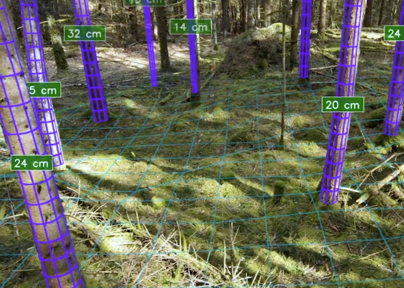
The use of smartphones and unmanned aerial vehicles (UAVs, commonly called drones) to measure forest inventory parameters represents one of the most democratising shifts in forest mensuration of recent decades, making high-quality data collection accessible to small forest owners, researchers, and operational crews who previously had to rely on expensive specialist equipment or contracted surveying services. Smartphone-based forest measurement apps leverage the device's camera, accelerometer, and GPS to perform functions such as diameter at breast height (DBH) estimation using photogrammetric or trigonometric methods, tree height measurement using clinometer-style inclination sensing, and basal area estimation using the phone camera as a virtual angle gauge. Apps including Trestima, Arboreal, and various research prototypes have demonstrated accuracy comparable to traditional field instruments in plantation and native forest conditions, with the added advantage of automatically digitising and geolocating each measurement for direct import into GIS and inventory databases. UAV-based forest measurement extends these capabilities to the stand and landscape scale, using photogrammetric point clouds derived from overlapping aerial imagery (structure-from-motion processing) or miniaturised LiDAR payloads to generate canopy height models from which dominant height, crown diameter, stocking density, and volume estimates can be extracted using automated algorithms. In Australia, UAV forest inventory has been adopted by plantation managers, state forestry agencies, and research organisations including the Australian Forest and Wood Products Research and Development Corporation (FWPA) for applications ranging from pre-harvest cruising to post-harvest regeneration assessment and environmental compliance monitoring. Regulatory requirements from the Civil Aviation Safety Authority (CASA) govern UAV operations in Australia, and the industry has developed operational protocols to integrate drone surveys safely and efficiently into routine forest management workflows.
¶ Assessment
A promising and accessible solution that significantly improves measurement precision and reduces labour exposure, though broader ecological or long-term risk reduction is not deeply evidenced.
¶ Details
| Field | Value |
|---|---|
| Company | Katam Technologies AB |
| Country | Sweden |
| Type | Company |
| FWPA RD&E | 7.3 |
| Case Studies | https://www.katam.se/case-studies/ |