¶ UAV LiDAR module L1/L2 Zenmuse
| Company | DJI |
| Country | China |
| Website | https://enterprise.dji.com/zenmuse-l2 |
| Category | Planning & Inventory › Remote sensing & mapping |
¶ Overview
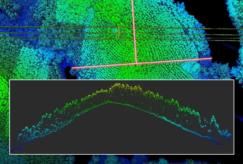
The DJI Zenmuse L1 and L2 are integrated LiDAR and photogrammetry payload modules designed for use on DJI enterprise drones — principally the Matrice 300 RTK and Matrice 350 RTK platforms — and represent a significant step in making survey-grade airborne LiDAR accessible to a broad range of forestry, survey, and environmental monitoring practitioners. The Zenmuse L1, released in 2021, combined a Livox Avia LiDAR sensor with a 20-megapixel RGB camera and a three-axis stabilised gimbal, offering up to 240,000 points per second, a maximum range of 450 metres, and simultaneous photogrammetry capture for point-cloud colourisation. The Zenmuse L2, released in 2023, significantly upgraded performance with a 5-returns system, up to 240 m effective range under real-world conditions, improved IMU integration for better trajectory accuracy, and higher point density at standard survey altitudes, enabling more reliable penetration of dense forest canopies to capture ground and sub-canopy returns. In forestry applications, both modules are used extensively for digital terrain model (DTM) generation beneath canopy, canopy height model production, individual tree height measurement, stem density estimation, and biomass proxy calculations. Australian forestry companies and government agencies use the L1 and L2 for plantation inventory — measuring tree heights across pine and eucalypt estates with accuracies comparable to traditional field mensuration — as well as post-fire vegetation recovery mapping, koala habitat connectivity assessment, and carbon project verification. The modules integrate with DJI Terra and third-party software such as LiDAR360, Global Mapper, and CloudCompare for point-cloud processing. Compared to manned-aircraft LiDAR campaigns, drone-mounted L1/L2 systems reduce mobilisation cost for site-scale surveys, though flight endurance limits coverage to roughly 1–2 km² per battery set under typical forestry survey parameters.
¶ Assessment
Provides fast, detailed spatial data that improve planning and significantly lower safety and operational risks linked to poor terrain awareness.
¶ Details
| Field | Value |
|---|---|
| Company | DJI |
| Country | China |
| Type | Company |
| Available in AU? | yes |
| FWPA RD&E | 7.3 |
| Case Studies | https://www.toolsforforesters.co.nz/__data/assets/pdf_file/0007/99718/9.-RSCG2023-In-house-LiDAR.pdf |