¶ Tree diameter estimation using UAV and SLOAM
| Authors | Chen et al. |
| Country | University of Pennsylvania, USA and University of Sao Paulo, Brazil |
| Paper (PDF) | View paper |
| Category | Planning & Inventory › Remote sensing & mapping |
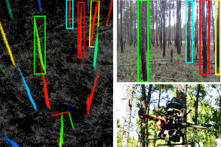
method more robust than traditional LiDAR and image based methods
0
¶ Overview
Tree diameter estimation using UAV (Unmanned Aerial Vehicle) and SLOAM (Semantic LiDAR Odometry and Mapping) represents an advanced remote sensing methodology that combines drone-borne LiDAR scanning with simultaneous localisation and mapping algorithms to extract individual tree stem diameters across forest stands without ground-based measurement. SLOAM is a LiDAR-based SLAM (Simultaneous Localisation and Mapping) technique originally adapted from mobile robotics that allows a UAV equipped with a lightweight LiDAR sensor to build a dense, georeferenced 3D point cloud of the forest environment while concurrently estimating its own position and orientation, even in GNSS-denied or signal-degraded conditions under a forest canopy. Once the point cloud is generated, semantic segmentation algorithms classify returns as ground, stem, branch, or canopy voxels; individual tree stems are then isolated and fitted with geometric primitives — typically circles or cylinders — at breast height (1.3 m above ground) to derive diameter at breast height (DBH), the standard inventory measurement used in volume and biomass estimation. Research published by groups including those at the University of Lincoln (UK) has demonstrated that UAV-SLOAM systems can achieve DBH estimation accuracies within 1–3 cm RMSE compared to manual caliper measurements, even in structurally complex forest environments. The technique is particularly valuable for large-scale forest inventory in areas where ground crew deployment is costly, hazardous, or time-consuming — including steep terrain, recently burned areas, or remote plantation coupes. In Australia, where plantation estate inventories in states such as Western Australia, South Australia, and Victoria cover hundreds of thousands of hectares, UAV-based diameter estimation has significant potential to reduce inventory costs while increasing measurement frequency and spatial resolution. Integration of SLOAM-derived DBH data with photogrammetric canopy height models and existing growth models supports improved yield forecasting and silvicultural decision-making across Australia's plantation and native forest estate.
¶ Details
| Field | Value |
|---|---|
| Company | Chen et al. |
| Country | University of Pennsylvania, USA and University of Sao Paulo, Brazil |
| Type | Paper |
| Year | 2019 |
| FWPA RD&E | 7.3 |