¶ Thermal drone surveys to detect arboreal fauna: Improving population estimates and threatened species monitoring
| Authors | Wagner et al. |
| Paper (PDF) | View paper |
| Category | Protection & compliance › Remote sensing & mapping |
0
¶ Overview
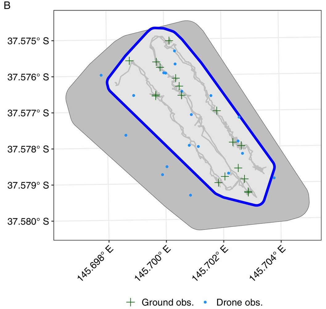
Thermal drone surveys use UAVs equipped with infrared thermal cameras to detect the heat signatures of arboreal (tree-dwelling) fauna in forest environments, offering a significant advance over traditional ground-based spotlight surveys and mark-recapture methods for estimating wildlife populations and monitoring threatened species. Animals such as gliders, possums, koalas, and owls emit body heat that is detectable against the cooler thermal background of foliage and bark, particularly during the cooler hours around dawn and dusk when temperature contrast is greatest. Thermal drones can survey forest transects rapidly and consistently, covering ground that would be inaccessible or prohibitively time-consuming on foot, and generate geo-referenced records of animal detections that can be used to build spatial population models. In Australia, this technology has gained considerable attention as a tool to address legal obligations under state and federal environmental legislation — including the Environment Protection and Biodiversity Conservation Act — that require forestry operators to assess impacts on threatened and listed species before and during harvesting operations. Species of particular concern include the greater glider (Petauroides volans), yellow-bellied glider, koala (Phascolarctos cinereus), and various owl species, all of which are sensitive to habitat disturbance. Research led by Australian universities and state forest agencies has demonstrated that thermal drone surveys can detect arboreal mammals with comparable or superior detection rates to conventional methods, while substantially reducing survey time and observer fatigue. Challenges include distinguishing between species, dealing with canopy obstruction, optimising flight altitude and speed for detection probability, and developing robust automated detection algorithms that can process large volumes of thermal imagery. Ongoing work is integrating machine learning classifiers with thermal image streams to enable near-real-time species detection and abundance estimation, which would transform pre-harvest fauna surveys from a weeks-long process to a rapid, data-rich assessment.
¶ Details
| Field | Value |
|---|---|
| Company | Wagner et al. |
| Type | Paper |
| Year | 2025 |
| FWPA RD&E | 7.3 |