¶ Semantic LiDAR sensing & mapping for forest inventory
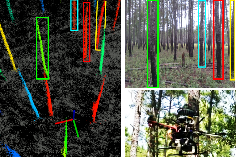
Description: This paper describes an end-to-end pipeline for
tree diameter estimation based on semantic segmentation and
lidar odometry and mapping. Accurate mapping of this type of
environment is challenging since the ground and the trees are
surrounded by leaves, thorns and vines, and the sensor typically
experiences extreme motion. We propose a semantic feature based
pose optimization that simultaneously refines the tree models
while estimating the robot pose. The pipeline utilizes a custom
virtual reality tool for labelling 3D scans that is used to train a
semantic segmentation network. The masked point cloud is used
to compute a trellis graph that identifies individual instances and
extracts relevant features that are used by the SLAM module. We
show that traditional lidar and image based methods fail in the
forest environment on both Unmanned Aerial Vehicle (UAV) and
hand-carry systems, while our method is more robust, scalable,
and automatically generates tree diameter estimations.
Snapshot: 0
Category: Remote Sensing, Imaging & Analytics
FWPA RD&E: 7.3
¶ Details
| Company | Country | Type | Website | Available in Australia? | Year | Status | Remarks | TRL | Employees | Colour | Inventors | Patent Model. |
|---|---|---|---|---|---|---|---|---|---|---|---|---|
| Chen et al. | University of Pennsylvania, USA and University of Sao Paulo, Brazil | Paper | Link | 2019 | Red |