¶ RS with LiDAR and aerial images
| Authors | Pearse et al. |
| Country | Flinders University Adelaide and Sicon New Zealand |
| Paper (PDF) | View paper |
| Category | Planning & Inventory › Remote sensing & mapping |
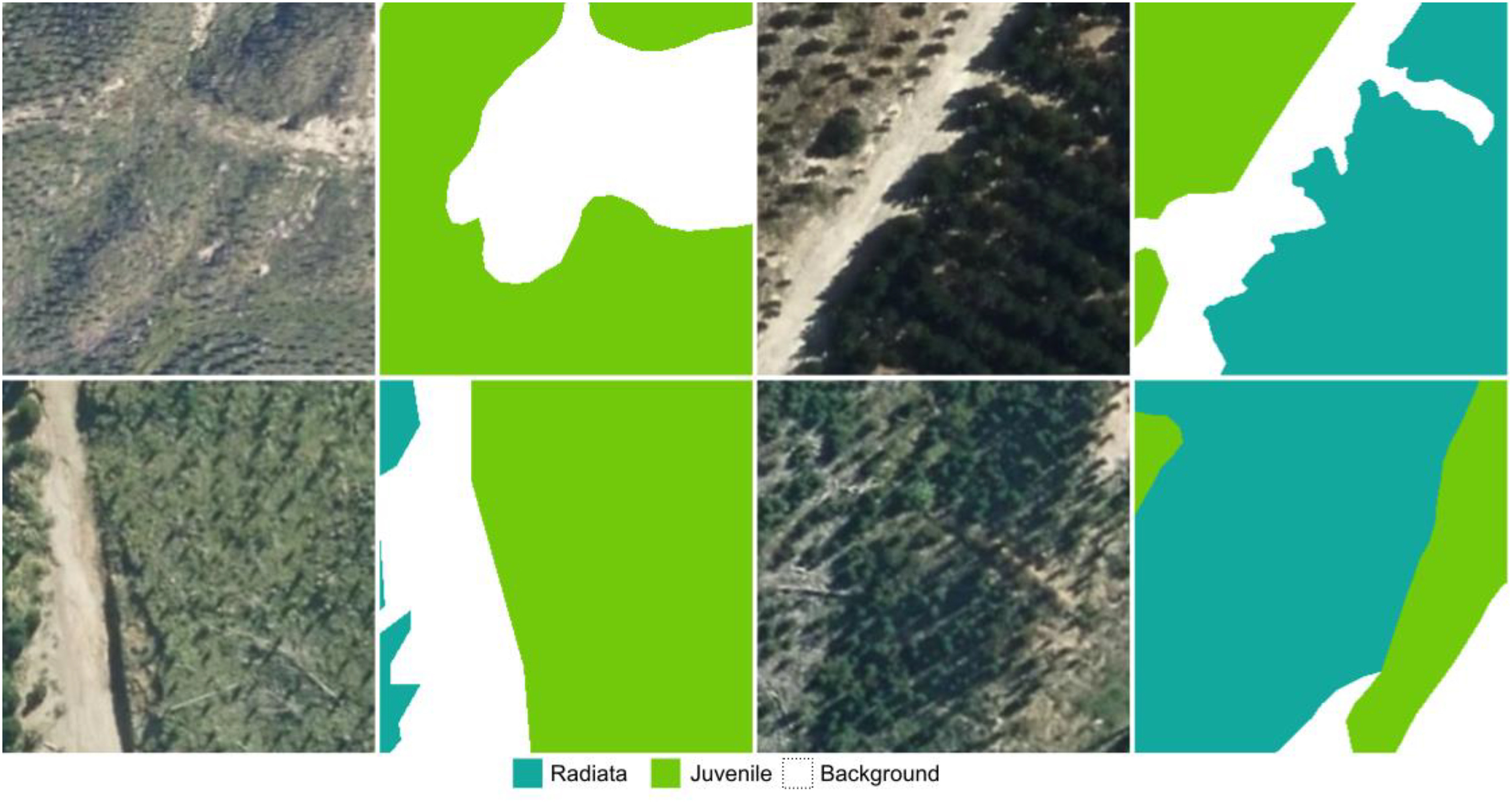
demonstration of RS based forest description in NZ
0
¶ Overview
Remote sensing (RS) that combines LiDAR (Light Detection and Ranging) with aerial imagery represents one of the most powerful data fusion approaches available to modern forestry. LiDAR works by emitting rapid laser pulses from an airborne platform — fixed-wing aircraft, helicopter, or UAV — and measuring the time taken for each pulse to return after striking a surface; from millions of such returns, a highly accurate three-dimensional point cloud is constructed that captures both the top of the forest canopy and, through canopy gaps, the ground beneath. Aerial imagery, typically captured simultaneously using RGB, near-infrared, or multispectral cameras, provides the spectral and textural detail that LiDAR alone cannot supply. When fused, the two datasets allow analysts to derive a comprehensive suite of forest structural and compositional attributes: tree height, crown diameter, basal area, stem volume, above-ground biomass, canopy cover, and species classification. Processing pipelines commonly apply algorithms such as individual tree segmentation, normalised digital surface models (nDSM), and machine-learning classifiers to extract these attributes at the stand or individual-tree level. In Australian forestry, airborne LiDAR combined with aerial photography has been widely adopted by state forestry agencies and private plantation managers to replace or supplement costly ground-based inventories across the vast eucalypt and softwood plantation estate. Agencies such as the Australian Bureau of Agricultural and Resource Economics and Sciences (ABARES) have used LiDAR-derived canopy height models to underpin national forest monitoring under Australia's Emissions Reduction Fund and carbon reporting obligations. The technology is equally valuable for native forest management: mapping old-growth habitat, detecting illegal clearing, assessing post-fire recovery, and monitoring invasive species. UAV-borne LiDAR systems have further democratised access, enabling smaller contractors and research teams to capture sub-decimetre point clouds over plantation coupes or restoration sites at a fraction of historical airborne survey costs.
¶ Assessment
Enhances inventory accuracy and reduces planning and hazard-assessment risk, though productivity gains are moderate.
¶ Details
| Field | Value |
|---|---|
| Company | Pearse et al. |
| Country | Flinders University Adelaide and Sicon New Zealand |
| Type | Paper |
| Year | 2024 |
| FWPA RD&E | 7.4 |
| Remarks | 0.0 |
| Case Studies | 0 |