¶ Remote Sensing Satellite Services
| Company | Meta |
| Country | United States |
| Website | https://sustainability.atmeta.com/blog/2024/04/22/using-artificial-intelligence-to-map-the-earths-forests/ |
| Category | Planning & Inventory › Remote sensing & mapping |
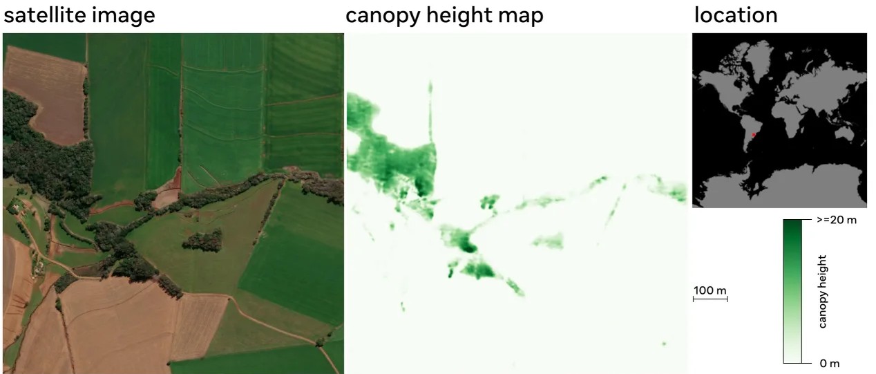
Commercial satellite-based forest monitoring services using AI and machine learning for forest cover classification, health assessment, and change detection.
¶ Overview
Remote sensing satellite services deliver earth-observation data collected by optical, radar, and multispectral satellite sensors and make it accessible to forestry practitioners via web platforms, APIs, and value-added analysis products. Satellites acquire imagery repeatedly over the same locations — some daily, others every few weeks — enabling temporal monitoring of forest cover, health, disturbance, and carbon stock at regional to continental scales. Key satellite constellations relevant to forestry include ESA's Sentinel-1 (C-band SAR) and Sentinel-2 (multispectral optical, 10 m resolution), NASA/USGS Landsat series, Planet Labs' commercial small-satellite fleets offering near-daily sub-5 m imagery, and the JAXA ALOS PALSAR-2 L-band SAR system, which is particularly effective for biomass estimation through forest canopy. Commercial satellite service providers such as Maxar, Airbus Defence and Space, and Australian company Geoscience Australia aggregate and process these data streams into subscription-based forestry analytics including canopy height models, disturbance alerts, and plantation growth tracking. In Australia, satellite remote sensing services underpin national programs such as the Australian Government's National Forest Inventory, the Savanna Burning Methodology under the Emissions Reduction Fund, and state-level forest monitoring conducted by agencies including the Victorian Department of Energy, Environment and Climate Action and the Tasmanian Department of Natural Resources and Environment. Australia's ICESAT-2 data usage and Geoscience Australia's Digital Earth Australia (DEA) platform exemplify how open-access satellite data and cloud-computing services are being combined to provide operational forest management support at low cost, making satellite-derived forest intelligence accessible even to smaller private forest growers.
¶ Assessment
Provides value for long-term strategic and policy planning by identifying degradation and deforestation, though its productivity impact is indirect.
¶ Details
| Field | Value |
|---|---|
| Company | Meta |
| Country | United States |
| Type | Company |
| FWPA RD&E | 4.4 |