¶ pathfinder to plan routes for replanting
| Authors | Hansson et al. |
| Country | Skogforsk (Research Modelte) |
| Paper (PDF) | View paper |
| Category | Nursery & Establishment › Remote sensing & mapping |
goal is to find paths, defines tree species and planting density, avoid Model-go ares and critical slopes. Modelt fully achived yet
0
¶ Overview
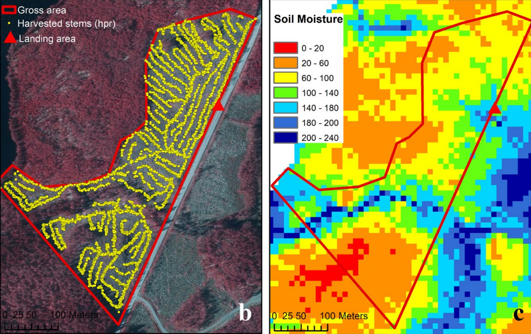
Pathfinder is a route planning tool developed specifically for the forestry replanting context, designed to optimise the movement of planting crews and machinery across recently harvested coupes in preparation for and during seedling establishment operations. The challenge of route planning for replanting is distinct from general logistics planning because post-harvest terrain is characterised by slash debris, residual stump fields, wet ground, steep gradients, and environmentally sensitive areas such as stream buffers and retained habitat patches — all of which constrain where planters and equipment can travel. Pathfinder addresses this by ingesting geospatial data layers including digital terrain models, soil trafficability assessments, coupe boundary information, and environmental exclusion zones to generate traversal routes that maximise planting crew efficiency while minimising ground disturbance and safety risk. The tool can calculate optimal sequencing for planting blocks within a coupe, identify access tracks suitable for tender vehicles carrying seedling stock, and flag areas where hand planting must substitute for mechanised approaches due to slope or obstacle constraints. In Australian plantation forestry, the post-harvest window for replanting is often time-critical, particularly in regions with defined planting seasons constrained by frost risk, soil moisture, or fire danger period restrictions. Tools like Pathfinder reduce the pre-planting reconnaissance burden on supervisors and allow planting crews to begin operations with a clear spatial plan that has already accounted for site-specific hazards. Integration with UAV-derived post-harvest surface models is an emerging capability that allows Pathfinder to update route recommendations based on as-harvested terrain conditions rather than pre-harvest survey data, significantly improving the accuracy of crew deployment plans in complex terrain.
¶ Details
| Field | Value |
|---|---|
| Company | Hansson et al. |
| Country | Skogforsk (Research Modelte) |
| Type | Paper |
| Year | 2024 |
| FWPA RD&E | 8.5 |