¶ Patent for monitoring of unstructured environments using UAVs
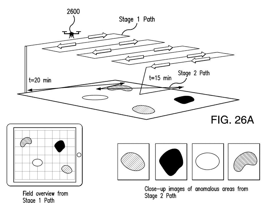
Description: The present disclosure provides a system for monitoring unstructured environments. A predetermined path can be determined according to an assignment of geolocations to one or more agronomically anomalous target areas, where the one or more agronomically anomalous target areas are determined according to an analysis of a plurality of first images that automatically identifies a target area that deviates from a determination of an average of the plurality of first images that represents an anomalous place within a predetermined area, where the plurality of first images of the predetermined area are captured by a camera during a flight over the predetermined area. A camera of an unmanned vehicle can capture at least one second image of the one or more agronomically anomalous target areas as the unmanned vehicle travels along the predetermined path.
Category: Remote Sensing, Imaging & Analytics
FWPA RD&E: 7.3
¶ Details
| Company | Country | Type | Website | Available in Australia? | Year | Status | Remarks | TRL | Employees | Colour | Inventors | Patent Model. |
|---|---|---|---|---|---|---|---|---|---|---|---|---|
| Univ Illinois | United States | Patent | Link | 27/6/23 | Active | Red | Chowdhary Girish, Soman Chinmay P, Barber Beau David | US 12117831 B2 |