¶ Inventory mapping
| Company | Lidar Solutions |
| Country | Australia |
| Website | https://www.lidarsolutions.com.au/lidar-solutions/lidar-survey-inspection-services/lidar-forest-survey-forestry-inventory-mapping-modelling/ |
| Category | Planning & Inventory › Remote sensing & mapping |
¶ Overview
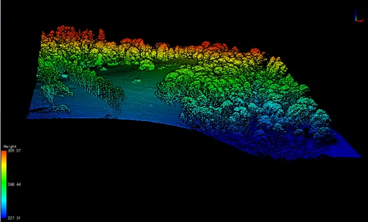
Inventory mapping in forestry refers to the systematic collection, spatial referencing, and analysis of data about forest resources — including tree species, stand density, basal area, timber volume, and canopy cover — across a defined area. Traditionally conducted through manual plot-based cruising, the field has been transformed by the integration of remote sensing technologies such as LiDAR, photogrammetry, and multispectral satellite imagery, enabling continuous and scalable mapping of forest assets. In modern forestry operations, inventory mapping underpins harvest planning, yield forecasting, environmental compliance, and carbon accounting. Geographic Information Systems (GIS) serve as the central platform for storing, analysing, and visualising inventory data, allowing foresters to overlay stand attributes with terrain, road networks, and ecological constraints. In Australia, organisations such as Forestry Corporation NSW and HVP Plantations rely on inventory mapping to manage large softwood and hardwood estate across challenging terrain, integrating aerial LiDAR surveys with ground-truthed plot data to produce high-resolution stand maps updated on rotation cycles. The adoption of Unmanned Aerial Vehicles (UAVs) has further democratised high-frequency inventory mapping, enabling plantation managers to detect stocking failures, pest incursions, or windthrow events within days of occurrence rather than waiting for scheduled aerial surveys. Machine learning classifiers applied to drone-captured RGB and multispectral imagery can now automatically delineate individual tree crowns and estimate height and diameter at breast height (DBH) with accuracy approaching traditional field measurements. The outputs of inventory mapping feed directly into harvest scheduling software and timber supply chain management systems, making accurate and current forest inventory a critical competitive and regulatory requirement for modern forestry enterprises. As carbon markets expand in Australia under mechanisms such as the Australian Carbon Credit Unit (ACCU) scheme, inventory mapping is also becoming essential for verifying sequestration claims in both plantation and native forest contexts.
¶ Assessment
A strong tool for improving inventory and planning accuracy, but its risk-reduction impact is limited by the lack of quantified evidence on how much operational or ecological risk is actually reduced.
¶ Details
| Field | Value |
|---|---|
| Company | Lidar Solutions |
| Country | Australia |
| Type | Company |
| FWPA RD&E | 7.3 |