¶ Insight Robotics aerial survey for forestry
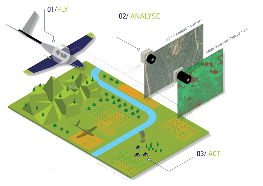
Description: Insight Robotics provides advanced aerial survey services and geospatial intelligence (GIS) tailored for forestry and agriculture, focusing on inventory assessment through high-resolution data capture and AI analysis. They specialize in large-scale land monitoring, precise mapping, and identifying, counting, and measuring assets in plantation settings.
Key Inventory Assessment Capabilities
Precision Aerial Mapping: Uses UAVs to create high-resolution digital orthophoto maps (DOM) and land-use mapping, including road and drain network mapping.
Plantation Census: Conducts palm census and inventory mapping to manage assets efficiently.
Crop Health and Growth Monitoring: Specialized packages for oil palm plantations provide, including identifying missing palms, monitoring palm greenness, and estimating yield performance.
Due Diligence Assessment: Enables landowners to assess land potential, soil quality (locating infertile land), and suitability prior to acquisition.
AI-Powered Analysis: Leverages machine learning to automate the detection of tree counts, pest outbreaks, and to distinguish terrain types
Category: Forest Modelling, Planning & Decision Support
FWPA RD&E: 7.3
¶ Details
| Company | Country | Type | Website | Available in Australia? | Year | Status | Remarks | TRL | Employees | Colour | Inventors | Patent Model. |
|---|---|---|---|---|---|---|---|---|---|---|---|---|
| Insight Robotics | Hong Kong | Company | Link | ~20 | Green |