¶ Framework to process LiDAR point clouds into meaningful classes for a forest inventory
| Authors | Shao et al. |
| Country | Purdue University, USA |
| Paper (PDF) | View paper |
| Category | Planning & Inventory › Remote sensing & mapping |
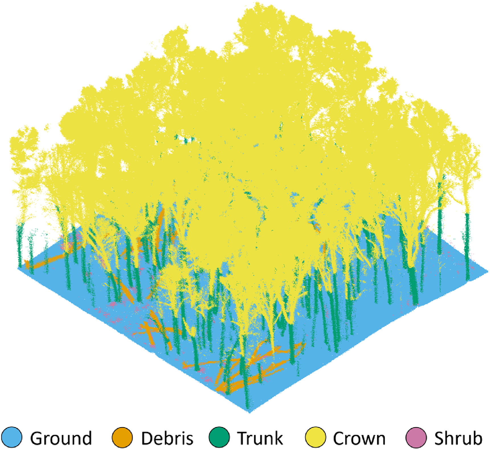
Classes: Ground, Debris, Trunk, Crown, Shrub; MAE for DBH between 1.45 to 5 .02 cm
0
¶ Overview
A framework to process LiDAR point clouds into meaningful classes for forest inventory is a structured computational pipeline that transforms the raw, unstructured three-dimensional point data acquired by airborne, terrestrial, or UAV-borne laser scanners into semantically labelled classes — such as ground, low vegetation, shrub, branch, stem, and canopy — and subsequently derives quantitative forest inventory attributes (tree count, basal area, stem volume, canopy height, and above-ground biomass) from those classified layers. The processing pipeline typically encompasses several sequential stages: noise filtering and outlier removal to eliminate spurious returns; ground point classification using algorithms such as Progressive Morphological Filtering (PMF) or Cloth Simulation Filtering (CSF) to separate ground returns from vegetation; normalisation of point heights relative to the digital terrain model; canopy height model (CHM) generation from the highest returns within each grid cell; individual tree segmentation using watershed, region-growing, or deep-learning approaches applied to the CHM or the three-dimensional point cloud directly; and attribute extraction (DBH, height, crown area) for each segmented tree, often cross-referenced against allometric models to predict volume and biomass.
The development of robust, generalisable frameworks has been a major focus of the international forest remote sensing research community, with open-source implementations available in R packages (lidR, rLiDAR, ForestTools), Python libraries (laspy, PDAL, py3dtiles), and commercial platforms (FUSION, TerraScan, LAStools). In Australia, the lidR package developed by Jean-Romain Roussel has been widely adopted by state forest agencies and researchers for processing airborne LiDAR acquired over plantation estates and native forests, with workflows tailored to the distinctive structural characteristics of eucalypt forests — multi-stemmed growth habits, irregular crowns, and high vertical stratification — that challenge algorithms designed for structurally simpler boreal or temperate conifers. Area-based approaches (ABA), which relate statistical summaries of point height distributions within grid cells to plot-measured inventory attributes through regression or machine learning models, remain the most operationally deployed method for large-area plantation inventory in Australia, providing wall-to-wall maps of stand volume and mean top height that directly feed into harvest scheduling and growth model initialisation. Ongoing research is advancing deep-learning point cloud classifiers (PointNet++, RandLA-Net) trained on labelled Australian forest scan datasets to improve individual tree detection rates in complex mixed-species and multi-aged stands.
¶ Details
| Field | Value |
|---|---|
| Company | Shao et al. |
| Country | Purdue University, USA |
| Type | Paper |
| Year | 2024 |
| FWPA RD&E | 7.3 |