¶ Forsite forest inventory services
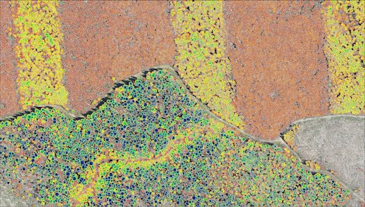
Description: Forsite combine the power of foresters, data (LiDAR/spectral) and machine learning. We use Forsite’s forestry knowledge and expertise to produce forest inventory products relevant to your needs, data and budget. Whether you need detailed information on individual trees or the attributes and characteristics of forest stands, Forsite’s forestry experts will work with you to understand your needs and recommend a technology solution that best meets those needs.
Using the power of LiDAR data, we can identify individual tree locations and attributes including species, height, diameter, and log products. Tree level data is a powerful tool for operational forest managers who need to plan harvest areas, identify forest products, model fire risk, understand forest health and predict fibre supply.
Using LiDAR, imagery, and ground plots to describe forest stands over large landscapes result in detailed, cost-effective inventories with known error estimates.
Category: Forest Modelling, Planning & Decision Support
FWPA RD&E: 7.3
¶ Details
| Company | Country | Type | Website | Available in Australia? | Year | Status | Remarks | TRL | Employees | Colour | Inventors | Patent Model. |
|---|---|---|---|---|---|---|---|---|---|---|---|---|
| Forsite | Canada | Company | Link | Green |