¶ Forestry scan
| Company | Multi Scan |
| Website | https://www.multiscan.digital/ |
| Category | Planning & Inventory › Remote sensing & mapping |
¶ Overview
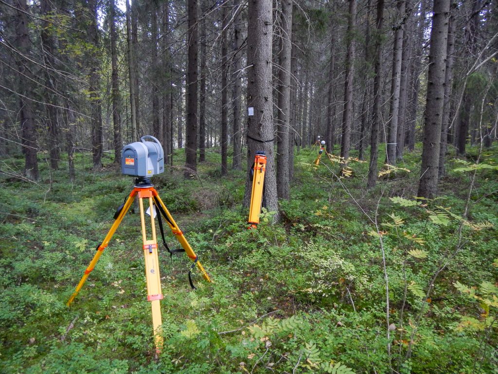
A forestry scan refers to the systematic acquisition of three-dimensional point cloud data within a forest environment using laser scanning technology — either terrestrial laser scanning (TLS) from fixed tripod-mounted instruments, mobile laser scanning (MLS) from vehicle- or backpack-mounted systems moving through the stand, or unmanned aerial vehicle (UAV)-borne scanning — to capture precise geometric information about individual trees, stand structure, and terrain. During a forestry scan, a rotating or oscillating laser emitter sends out pulses that reflect from surfaces within the scanner's range, with the instrument recording the time-of-flight (and in full-waveform systems, the complete return signal shape) to calculate the three-dimensional position of each reflection point. The resulting point cloud — which may contain millions to billions of individual points per scan session — is then processed through a pipeline of filtering, registration (aligning multiple scan positions into a common coordinate system), ground classification, and tree segmentation algorithms to extract per-tree measurements including diameter at breast height (DBH), stem height, crown dimensions, and stem straightness.
Forestry scanning has gained widespread adoption in research and is increasingly transitioning into operational use for pre-harvest inventory in high-value timber stands and for calibration of airborne LiDAR-derived inventory models. In Australian plantation forestry — particularly in radiata pine and hardwood eucalypt estates — TLS and MLS surveys have demonstrated the ability to measure stem DBH with root-mean-square errors of 1–3 cm compared to manual calliper measurements, with scan-based stem counts closely matching manual tally counts in stands of moderate density. Backpack-mounted mobile laser scanners, such as the ZEB Horizon (GeoSLAM) and Leica BLK2GO, have significantly reduced the time required to scan a forest plot compared to static TLS instruments, making operational deployment across large numbers of inventory plots more feasible. Research by the University of Melbourne, ANU, and CSIRO has advanced algorithms for automated individual tree extraction and measurement from Australian forest scan data, contributing to global methodological libraries used by forestry practitioners worldwide. Integration of scan data with harvester head measurement logs offers a promising pathway to end-to-end volume accountability from standing tree to log deck.
¶ Assessment
A useful tool for speeding up processing workflows and reducing grading or quality errors, providing direct operational risk reduction.
¶ Details
| Field | Value |
|---|---|
| Company | Multi Scan |
| Type | Company |
| FWPA RD&E | 7.4 |