¶ Forest inventory services
| Company | Forsite |
| Country | Canada |
| Website | https://forsite.ca/forest-inventories/ |
| Category | Planning & Inventory › Remote sensing & mapping |
¶ Overview
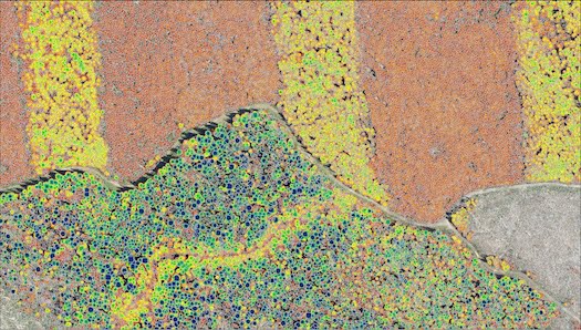
Forest inventory services are professional consulting and technical service offerings that provide forest owners, managers, and investors with accurate, statistically sound measurements and assessments of their forest resource base. These services range from traditional ground-based cruise surveys — where trained foresters walk systematic transects or visit random sample plots to measure tree dimensions, species composition, stocking density, and timber quality — through to fully integrated remote sensing solutions that combine airborne LiDAR, drone imagery, and satellite data with field validation to deliver wall-to-wall stand attribute maps. Deliverables typically include estimates of merchantable timber volume by species and log grade, stand-level maps of basal area, stems per hectare and mean top height, carbon stock assessments for market or regulatory purposes, and growth projections using calibrated growth models. In Australia, forest inventory services are provided by specialist consultancies such as PF Olsen Australia, Indufor, Timberlands Pacific, and various state forestry agency commercial arms, serving clients that include institutional timber investment management organisations (TIMOs), private plantation growers, and government forest managers. The adoption of airborne laser scanning (ALS) and drone-based photogrammetric point clouds has dramatically increased the spatial resolution and efficiency of inventory services, enabling individual tree detection across entire estate areas rather than statistical extrapolation from plots alone. Enhanced forestry inventory services also incorporate soil survey, biodiversity assessment, fire risk mapping, and road network analysis to deliver comprehensive resource management information packages. Data management platforms that integrate inventory outputs with geographic information systems (GIS) and enterprise resource planning (ERP) tools are increasingly standard, enabling near-continuous inventory updating as new remote sensing datasets are acquired and growth models are run forward.
¶ Assessment
A well-supported tool that enhances planning and operational decisions with detailed forest data, making it suitable for reducing uncertainty and various operational risks.
¶ Details
| Field | Value |
|---|---|
| Company | Forsite |
| Country | Canada |
| Type | Company |
| FWPA RD&E | 7.3 |