¶ EOSDA LandViewer multispectral imagery
| Company | EOS Data Analytics LandViewer |
| Country | United States |
| Website | https://eos.com/forest-monitoring/ |
| Category | Planning & Inventory › Remote sensing & mapping |
¶ Overview
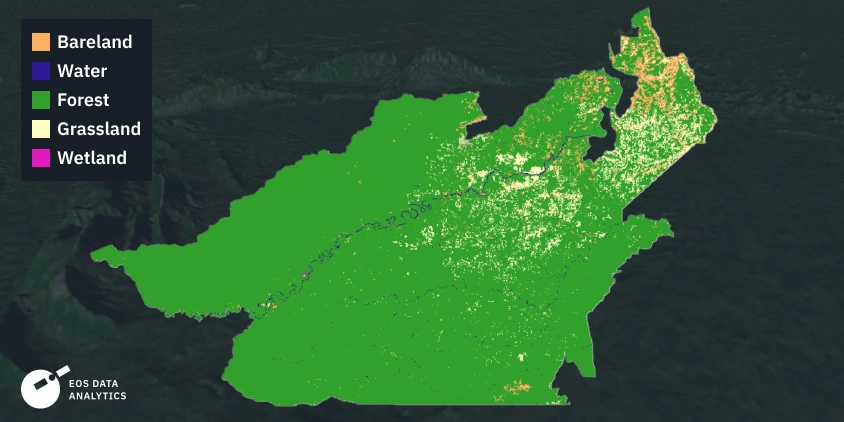
EOSDA LandViewer is a cloud-based geospatial analytics platform developed by EOS Data Analytics (EOSDA) that provides users with browser-based access to an extensive archive of multispectral satellite imagery from sensors including Sentinel-2, Landsat 8/9, SPOT, Pleiades, and commercial very-high-resolution satellites, alongside on-platform tools for visualising, processing, and analysing imagery using a range of spectral indices and band combinations without requiring local GIS software or programming expertise. In a forestry application context, LandViewer enables forest managers, ecologists, and planners to monitor vegetation condition, detect disturbance events, and assess stand-level attributes by leveraging spectral indices such as the Normalised Difference Vegetation Index (NDVI), the Normalised Burn Ratio (NBR), the Enhanced Vegetation Index (EVI), and moisture indices derived from shortwave infrared bands. Users can query the imagery archive for specific dates or periods, generate time-series comparisons to detect phenological changes or post-disturbance recovery trajectories, and apply pre-built or custom spectral index calculations to identify stressed or diseased vegetation, post-harvest regeneration progress, or drought-affected canopy areas at plantation or landscape scale. For Australian forestry operations, which encompass large plantation estates in southern states and extensive native forest management areas across multiple jurisdictions, satellite-based monitoring through platforms such as LandViewer provides a cost-effective and scalable complement to periodic aerial or drone surveys, enabling more frequent condition assessments than ground-based programmes can achieve. The platform is particularly useful for rapid post-fire canopy damage assessment, identifying areas of Phytophthora or insect defoliation, and tracking the establishment success of recently planted coupes across broad geographic extents, supporting both operational decision-making and regulatory reporting requirements.
¶ Assessment
A useful system that enhances management efficiency and reduces risks by detecting disturbances, health issues, and fire indicators early.
¶ Details
| Field | Value |
|---|---|
| Company | EOS Data Analytics LandViewer |
| Country | United States |
| Type | Company |
| FWPA RD&E | 7.3 |