¶ AFRY smart forestry tools
Recommended Technology
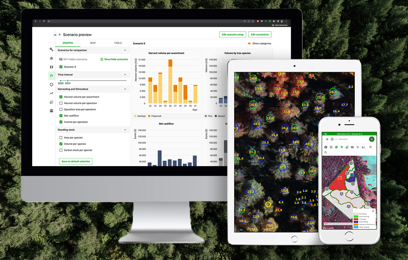
Description: AFRY Smart Forestry provides advanced digital solutions and consulting to optimize forest management, valuation, and supply chains. Through products like TreeMaps (remote sensing), Planner (strategic optimization), and Manager (data management), it helps owners and investors maximize sustainable productivity using data-driven insights.
Key Components of AFRY Smart Forestry:
TreeMaps: Processes drone, aerial, or satellite LiDAR/camera data to create a high-resolution 3D "digital twin" of forests for precise tree-level inventory, including species, height, and growth monitoring.
Planner: A software tool for strategic forest management that optimizes harvest schedules, analyses scenarios, and ensures sustainable wood supply.
Manager: A comprehensive system for managing forest inventory data, supporting operational planning, and ensuring data quality through validation rules.
Services: AFRY offers carbon footprint modeling (mapping carbon storage and emissions), forest valuation services for transactions, and strategic advisory for bioindustry and supply chain management
AFRY provides a mature, production‑grade forestry digital twin capability through its Smart Forestry portfolio, using remote sensing, AI‑based inventory, growth modelling, and scenario analysis to create operational digital representations of forest assets. Operating at TRL 8–9, its strength lies in delivering integrated, scalable estate‑level planning with minimal operational disruption. Value is generated through improved data quality and decision‑making rather than automation of field work, enabling incremental adoption. However, benefits are indirect and depend on data quality, update frequency, and whether insights are acted upon, with ongoing costs driven by remote sensing and cloud analytics requirements.
In practice, AFRY functions as a strategic decision layer of the forest operation rather than a real‑time operational system, supporting long‑term planning, carbon and Environmental, Social & Governance (ESG) analysis, and investment decisions. Its core tools - TreeMaps (inventory), Planner (scenario modelling), and Manager (operational integration) - form a cohesive digital‑twin ecosystem linking high‑resolution data with planning and management. As such, AFRY is best positioned as the “strategic brain” within a broader digital forestry architecture, complementing execution and optimisation platforms rather than replacing them.
Category: Remote Sensing, Imaging & Analytics
FWPA RD&E: 7.3
¶ Details
| Company | Country | Type | Website | Available in Australia? | Year | Status | Remarks | TRL | Employees | Colour | Inventors | Patent Model. |
|---|---|---|---|---|---|---|---|---|---|---|---|---|
| AFRY | Sweden | Company | Link | yes, office in Brisbane | Green |