¶ Aerial surveys & inventory mapping
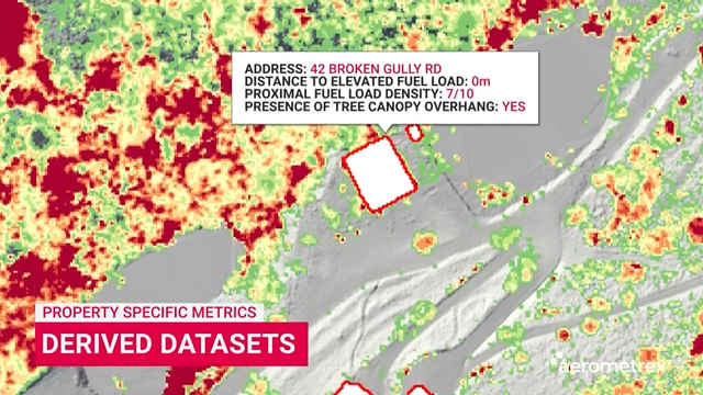
Description: Aerial LiDAR plays a critical role in modern forestry and carbon farming by capturing detailed information about vegetation structure and ground conditions across large areas. It enables consistent, repeatable measurement that supports both operational planning and long-term environmental outcomes.
Aerometrex delivers high-quality LiDAR and derived datasets, including classified point clouds, elevation & vegetation datasets, tailored to project and reporting requirements.
Using this data, forestry and carbon project teams can:
Quantify vegetation structure at scale – measure canopy height, density and distribution across large landholdings.
Support carbon accounting workflows – provide robust spatial inputs for modelling biomass and carbon sequestration.
Understand terrain and access constraints – inform harvesting, planting and ongoing land management activities.
Demonstrate change over time – support baseline establishment, monitoring and verification for carbon projects.
Beyond commercial forestry, LiDAR also supports broader land and vegetation strategies, including reforestation, regeneration and urban greening initiatives, where accurate canopy and terrain data underpins effective planning.
Category: Remote Sensing, Imaging & Analytics
FWPA RD&E: 7.3
¶ Details
| Company | Country | Type | Website | Available in Australia? | Year | Status | Remarks | TRL | Employees | Colour | Inventors | Patent Model. |
|---|---|---|---|---|---|---|---|---|---|---|---|---|
| Aerometrex | Australia | Company | Link | Green |